


On the Grounds of Foulis Castle #1
When I was in kindergarten, Mrs. Dorothy Adams, our kindergarten teacher presented each one of us with our very own box of Crayola crayons. Upon opening the the box, the green one was so beautiful, it became my instant favorite. So it continues today to this meadow on the grounds of Foulis Castle.

On the Grounds of Foulis Castle #2
As you will discover in following me, stonework fascinates me. I particularly like the texture of stones and mortar so that this image conveys tactile as well as optical perceptions. The wooden post is a nice contrast to the living wood and to the stone. In viewing stonework, I enjoy imagining the chatter of the masons on the very day they were erecting this section.
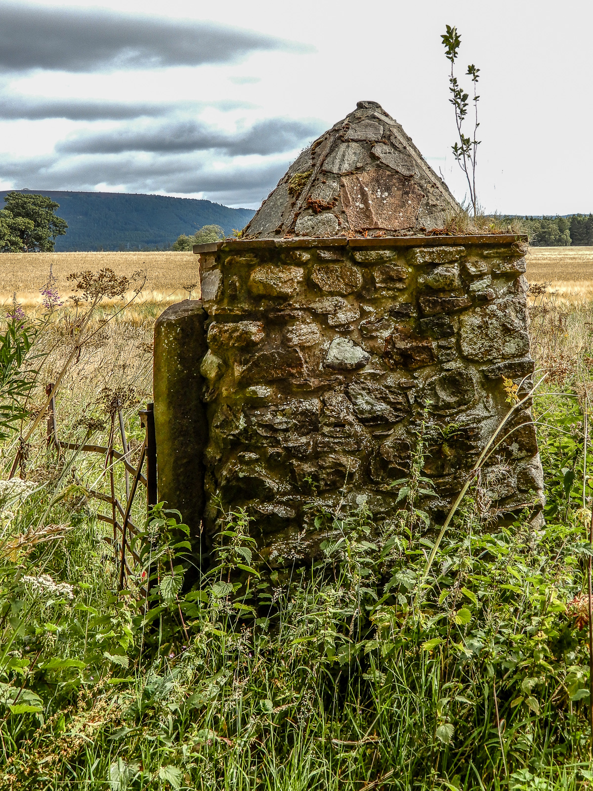

On the Grounds of Foulis Castle #3
More stonework in this cairn. My eye was drawn to the concavity of some of the stones and to the subtle shifting of the structure as it leans to the left. This image introduces a new substance, metal. The pyramid on top of the cairn is particularly evocative, and I sense the obvious pride of the mason who lovingly arranged the stones.

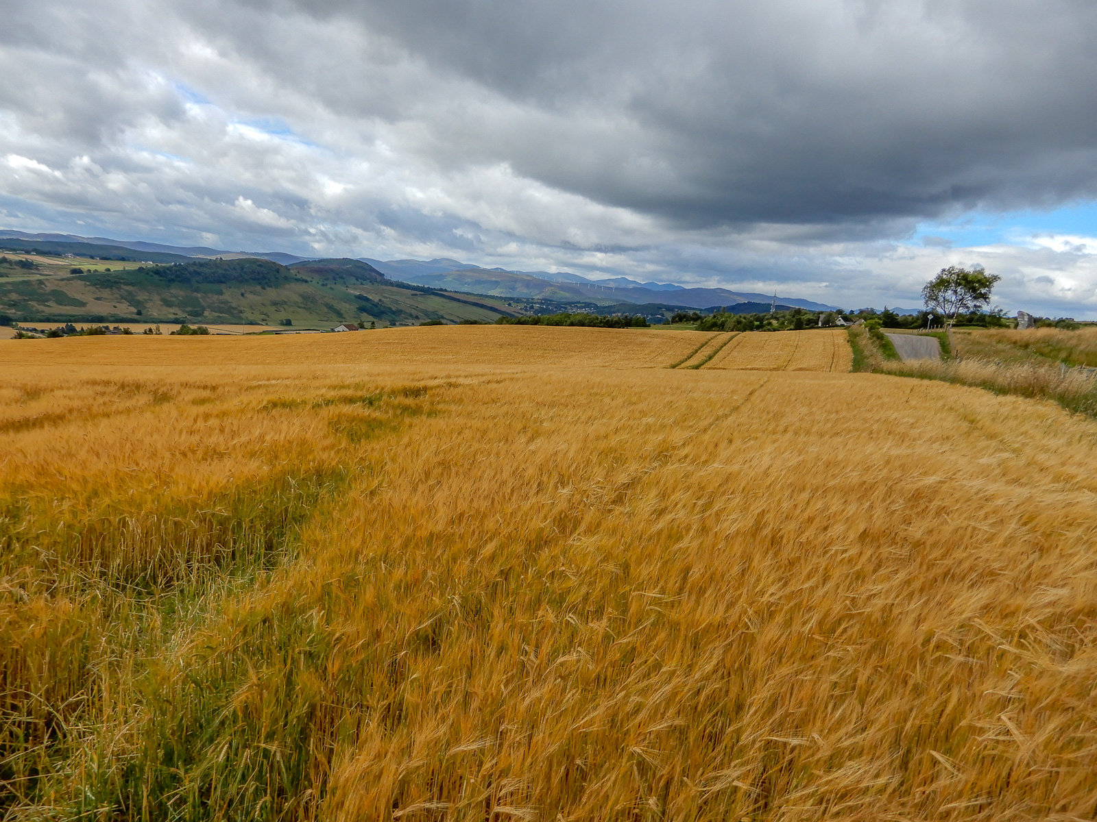
On the Grounds of Foulis Castle #4
The castle itself. The yellow of the rye fields indicates the ripeness and the good health of the crop. Because this is a working farm, no tours of the castle or grounds are offered to visitors.
On the Grounds of Foulis Castle #5
More rye. In these far northern latitudes near the top of Scotland, the sun never rises high in the sky even in August.
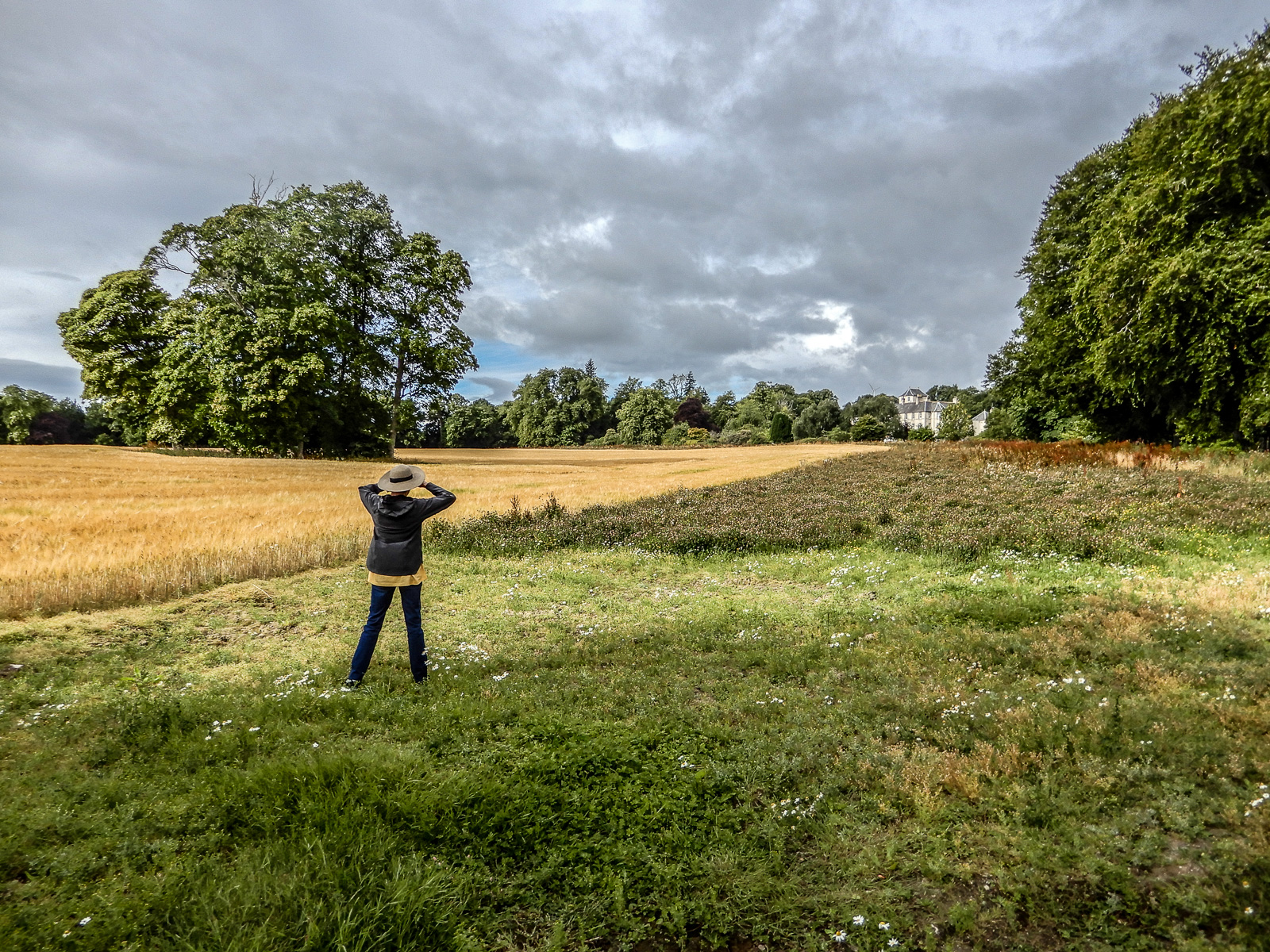
On the Grounds of Foulis Castle #6
This is my good friend, Susan Jarvis, one of my traveling companions from Salt Lake City. She is a much sought after artist in Utah (susannjarvis.com). Her preferred media are oil and acrylic but she does wonderful sketches and watercolors. I am grateful to Susie who taught me to be conscious of color.

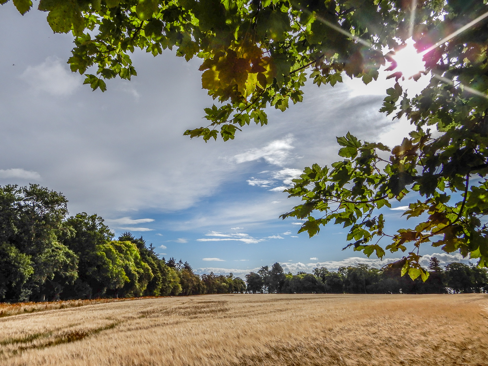
On the Grounds of Foulis Castle #7
Although the redundancy of the rye fields has the potential to become tiresome, the sky compels me to include this image. The sky in the Highlands changes dynamically by the minute where no land is far from one, two or even three seacoasts, not to mention the firths and lochs.

On the Grounds of Foulis Castle #8
Sometimes when we are in a country new to us, we are mesmerized by the different. I also take some time to look for the familiar. Although I am certainly no botanist when it comes to scientific or common names, I pay much attention to plants and their distinguishing leaves, flowers, and fruits. Many of these plants also flourish in the meadows of northern Utah. Some of their siblings are flourishing in a strip of land between a fence and the street on one side of my yard.

On the Grounds of Foulis Castle #9
The same perspective as #5 but a longer focal length and exactly five minutes later. Notice the thinning of the clouds and more blue sky sneaking through.
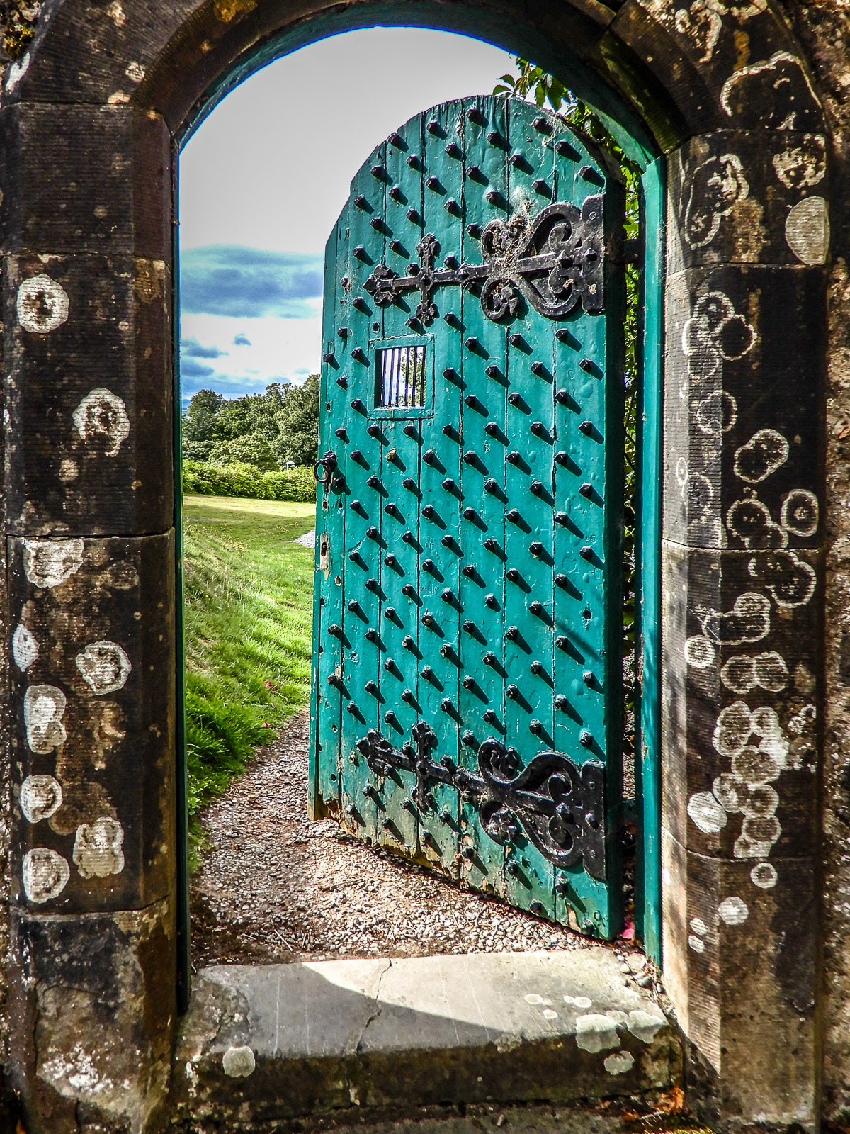
The Green Door at Tulloch Castle
I cannot take credit for this image. The credit goes to Tim Winterburn, a professional Highlands photographer (timwinterburn.co.uk) who served as our guide and instructor this August morning. Tim is a scientist/engineer turned professional artist/guide who in a few short hours completely surpassed my eager expectations of this photo excursion into the Scottish Highlands. Tim was excited about this gate and held it open from behind while we took turns with our cameras. Frankly, the door did not inspire me, but I dutifully took some snaps. Back home in Utah I was doing post processing when my spouse walked by and stopped to admire this image on the monitor. Her action was significant because she has a high threshold before art, especially photographic, grabs her attention. Tim, if you ever read this, thank you!
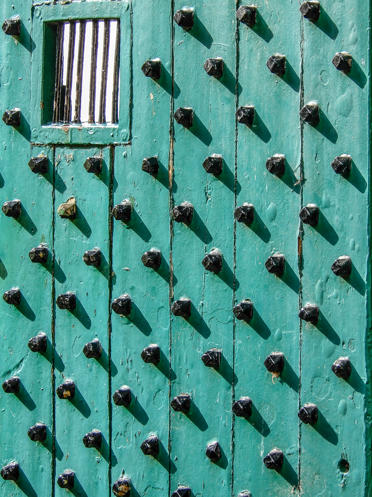
Closeup of the Green Door at Tulloch Castle
I am fascinated by the power of photography because you can capture an image in the field and then later process it and see what you got. It was that very power of photography that transformed the science of astronomy beginning in the later 19th century. Although the entirety of the green door did not inspire me at first, I have long learned to trust the power of closeup photography to produce surprising results.

Exterior Wall of Tulloch Castle
Another example of a closeup. My eye welcomes exploring this wall. Tulloch Castle today is a hotel and conference center but has served as a fortification at times since the 12th century. This wall is likely no newer than 1746 and could be a few hundred years older. The Scots and many other Europeans do not obsess about the age of structures which just seem to have always been present. The obsession about dating structures manifested by some inhabitants of America has a way of sometimes trivializing deeper meaning. Nevertheless, I will continue with my American obsession with dates.
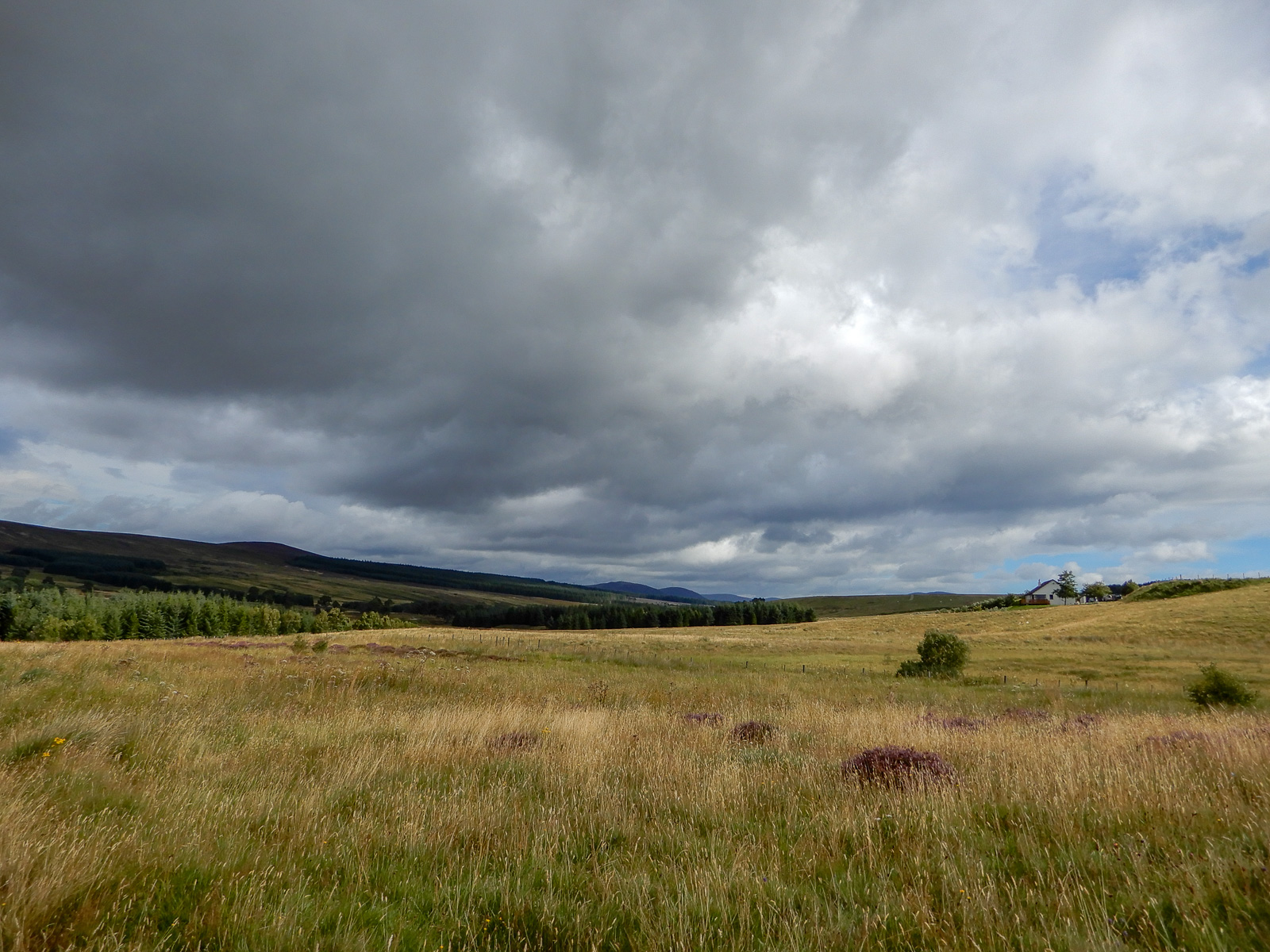
Near the Heights of Brae #1
Because I do not know how place names work in Scotland, the most I feel comfortable stating is that this is near the heights of Brae. We were on a dirt road and even past a gate that we had to open and close behind us. I infer that the River Sgitheach is marked by the row of trees growing along its bank. Collins English Dictionary – 13th Edition (2018; HarperCollins; Glasgow) says that a generic brae (Scottish word) is a hillside, but again by inference here it is a proper name referring to the hillside whose northern tip enters this image from the left. I confess that I easily get lost in words and analysis. I am telling myself to stop and instead just concentrate nonverbally on this moor and the pregnant clouds pressing down on it.
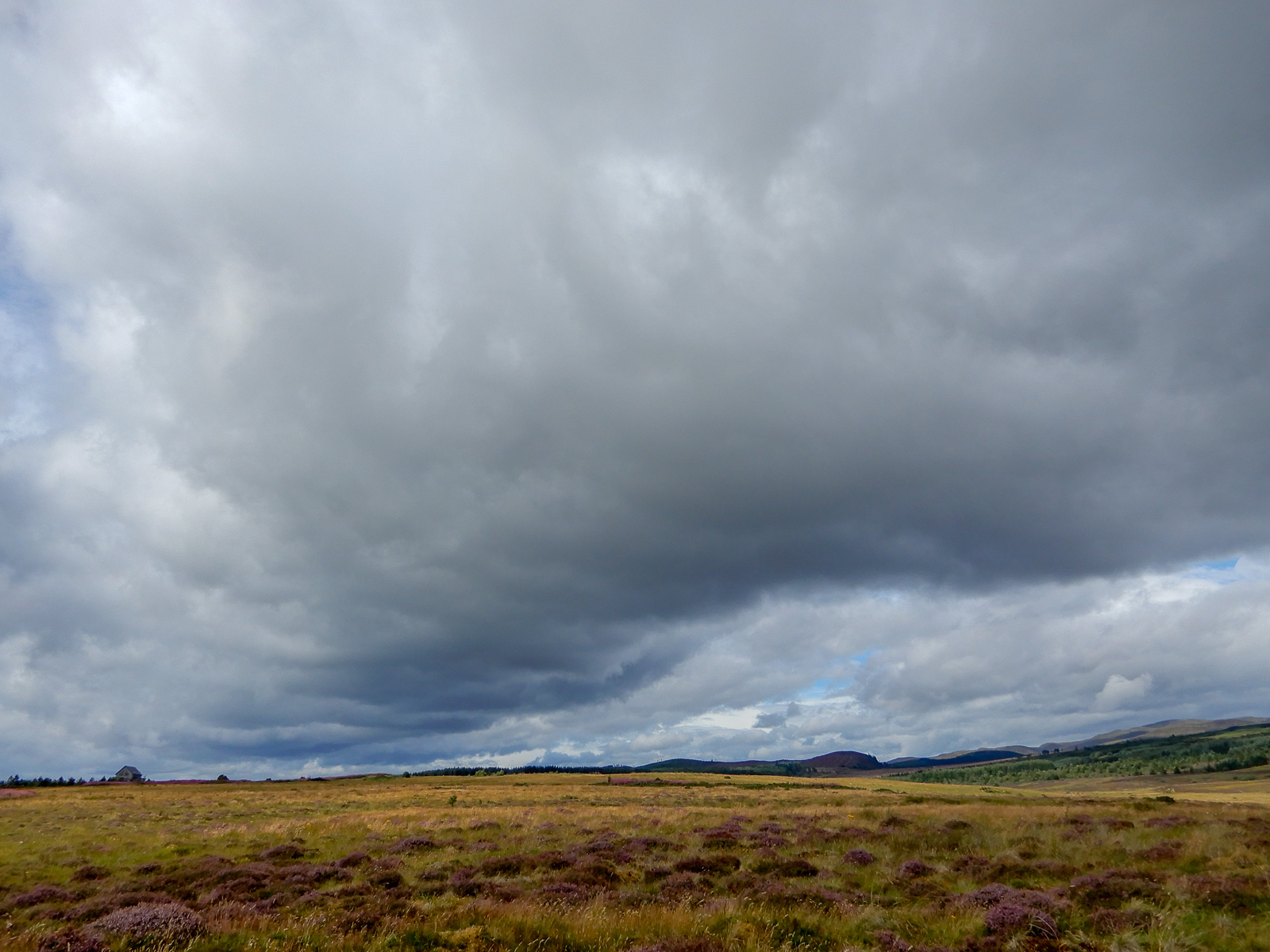
Near the Heights of Brae #2
Another view of the moor and the looming roll cloud. The plant with the purple blooms is heather.
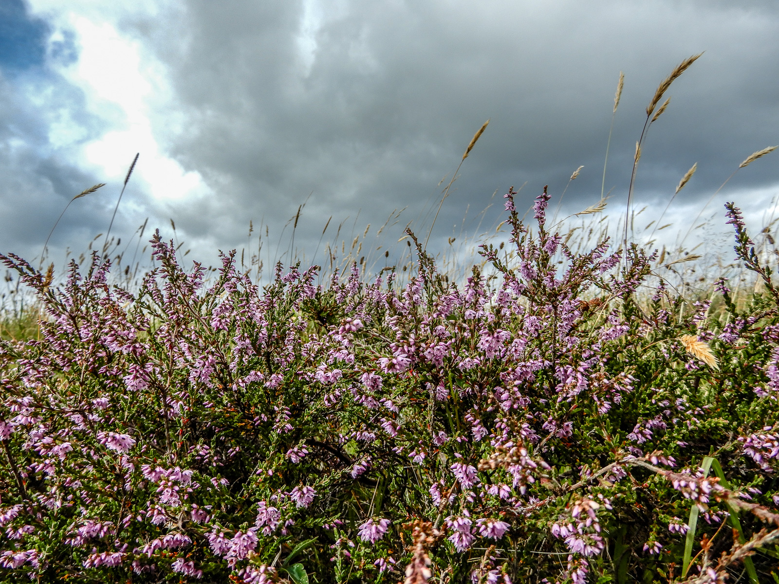
Heather near the Heights of Brae
For me coming from the Great Basin of the western USA and its alkaline soils, acid-loving heather would, indeed, be an exotic plant. This is a ground level perspective from the shoulder of the dirt road.
Field of Rye Near the Heights of Brae
Note the dirt road on the far right. The road is visible on the Google Maps satellite view but not the map view.
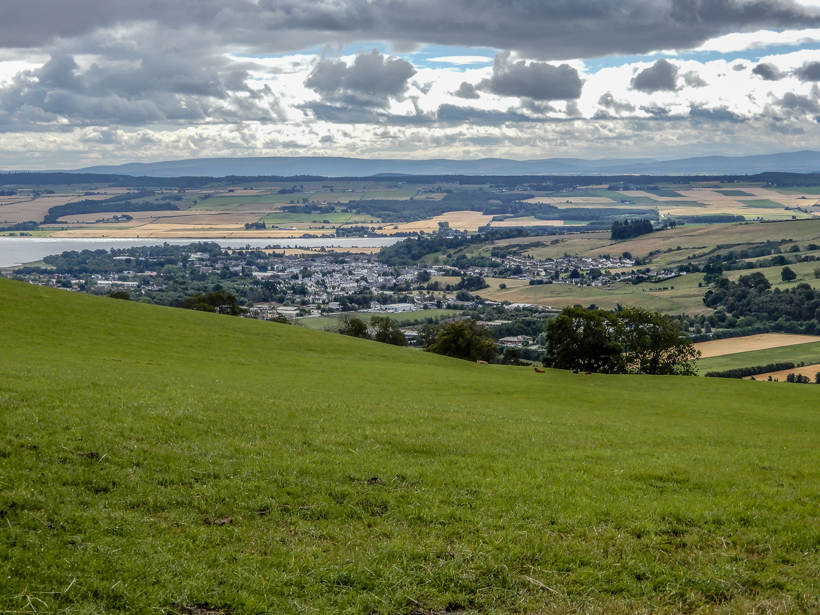
On the Heights of Brae Overlooking Dingwall
This panorama is roughly looking east. In the very center of the image, please notice the tower ruin of Dingwall Castle. It began in the 11th century, and the imposing stone citadel dates to the 14th century. It has lain in ruins since the 18th century. The fortress figures prominently in Scottish history. Many people have relished the speculation it is the birthplace of Macbeth. The visible water belongs to the Cromarty Firth. If you continued to the right out of the photo you would soon encounter Loch Ness too far and obstructed anyway to see from this vantage point. To the crest of the rise beyond Dingwall is the appropriately named Black Hill. The Black Hill is hiding our view of the Moray Firth. Finally, the long range of mountains in the distance are on the other side of Moray Firth. The North Sea lies just beyond the leftmost tip of the mountains. The dimensionality of the sky and clouds is obviously linked to the alternating landmasses and firths.

Ruin of a Parish Church in Dingwall
Tim Winterburn (please see The Green Door above) took our group to this abandoned church to time our arrival with the sun shining through the windows onto the grass. The problem was that the sky was thinly overcast with only one little hole in the clouds. Tim got me into position and watched the cloud opening move toward the sun. About a minute ahead of time, I started shooting and managed to capture this image during the few seconds of full sun. This church dates from 1861 when it was built as a parish church of the Free Church of Scotland which resulted from a schism with the established Church of Scotland.The schism was known as the Disruption of 1843. The building was abandoned as a place of worship in the 20th century, and a private owner acquired it to build his retirement home in the back of the lot.
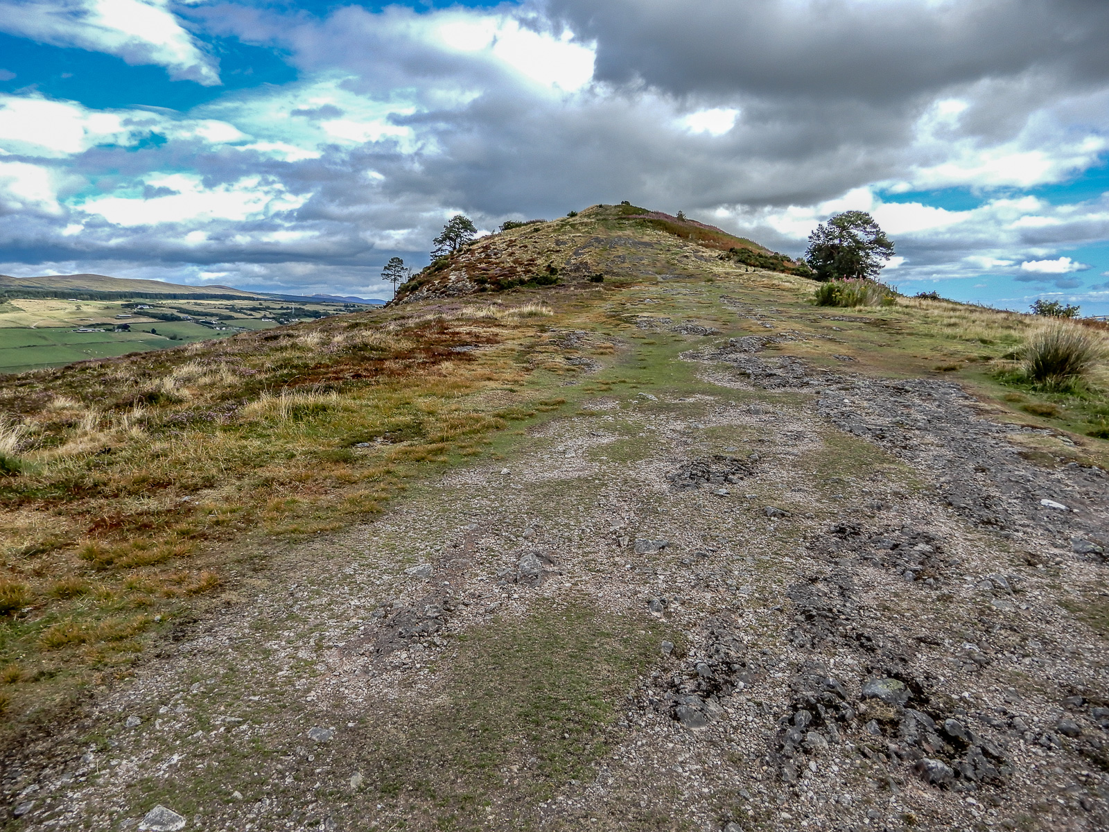
Crest of Knock Farril
The crest of the hill called Knock Farril. This site contains the archaeological remains of an Iron Age fort. I include this photo only to give some context to the Knock Farril photos below. My overwhelming wonder at being in a landscape new to me caused me to forego my interest in history and instead use the hill as a vantage point to grasp at capturing a few memories of the stunning Highlands. As photos go, this one is not bad. One could argue it would be more compelling to have placed the horizon lower and included more of the dramatic sky. But the hill itself is the history. The soil was hard and lava like underfoot I infer from the human made vitrified rock. I imagine the people of the Pict culture on this hill absorbed in their mundane thoughts. If they looked out, it was only for spotting animals, enemies or weather. This prehistoric site spelled Knock Farril is not to be confused with the nearby village of Knockfarrel.
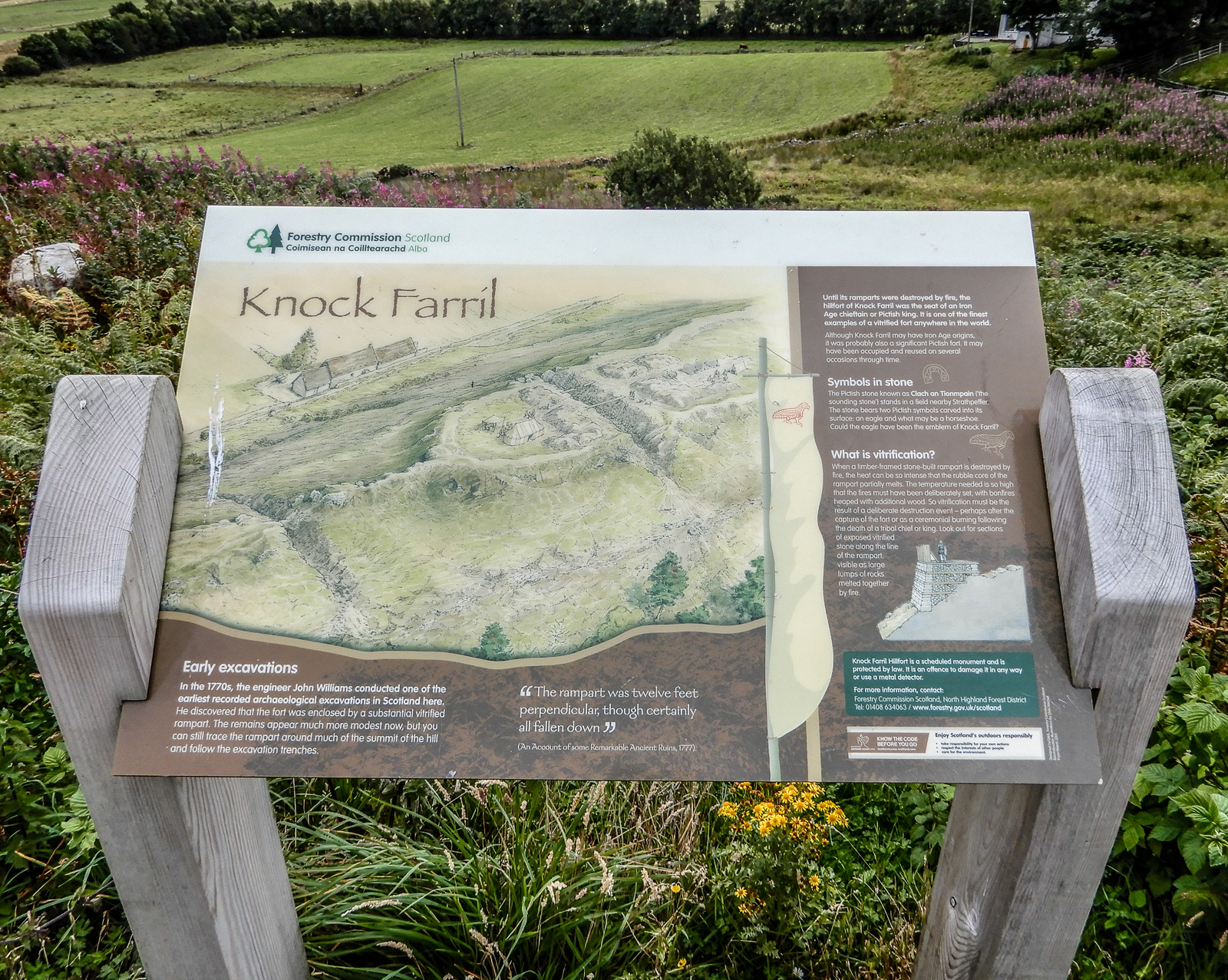

Interpretive Sign for Knock Farril (#2)
I include this interpretive sign for those of you who want to follow up on the prehistory of this place and the vitrification of turning stone into glass by means of fire. Notice the drawing of the crest of the hill, previous photo, with the fort on the lower right.
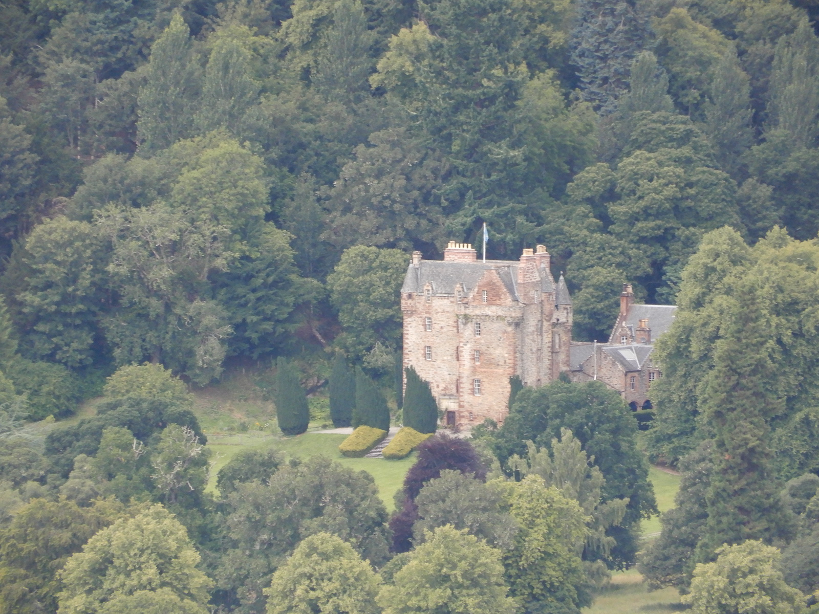
Castle Leod from Knock Farril
I spotted this castle in the trees on the other side of the valley from Knock Farril. It was about 2.3 miles/3.7 kilometers away. I feel lucky to get this shot, another study in green with very old stonework. Reportedly, the same family has been handing down possession of this castle for 500 years. It is open to visitors and can be hired for wedding receptions etc.
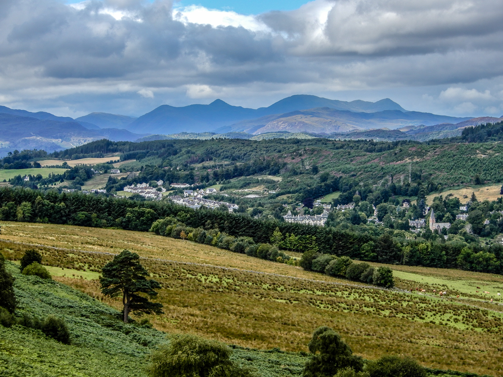
Knock Farril, Strathpeffer and Ben Wyvis
From Knock Farril the village of Srathpeffer. The imposing mountain range in the far distance is Ben Wyvis. Ben means mountain peak in Scottish. The church on the far right in the middle ground is St. Anne’s and is Scottish Episcopal. George Washington Wilson, a famous Scottish photographer captured this same scene from a slightly different vantage point in 1863. Here is a link to his stereo photo: (https://www.google.com/search?q=george+washington+wilson+strathpeffer&tbm=isch&tbo=u&source=univ&sa=X&ved=2ahUKEwj37byMu8PfAhXtq4MKHWI_B40Q7Al6BAgFEA8&biw=1920&bih=939&dpr=2#imgrc=7jljiUWi2KgRuM). To the best of my knowledge, the church in Wilson’s photo no longer exists, although it is similar to St. Anne’s which was built much later.