This post is a follow-up the to immediately preceding post on the Silver Island Mountains. Antelope is the largest island in the Great Salt Lake (GSL) and is 15 mi/24 km long (north to south) and 4.8 mi/7.8 km wide. The Great Salt Lake itself is the sixth largest lake in the USA, ranking behind the five Great Lakes along the Canadian-American border.
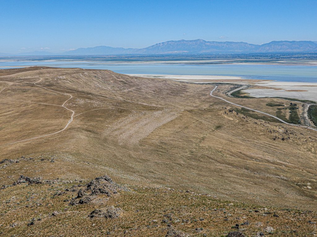
On the Trail to Dooly Knob (#1)
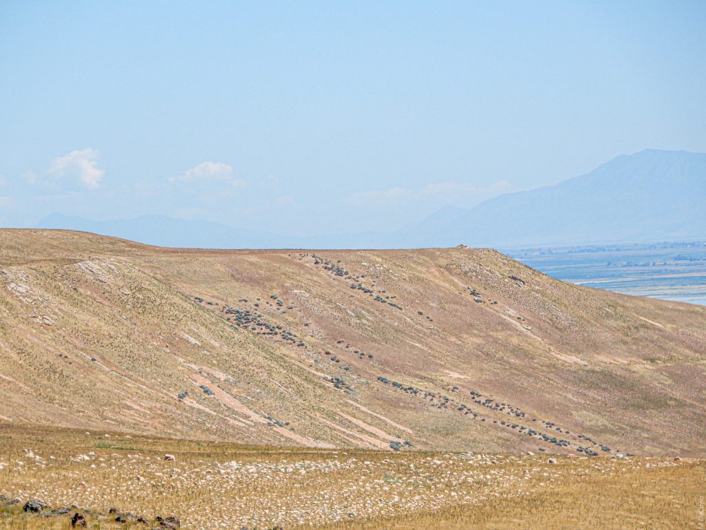
This hike started at an elevation of 4514 ft/1376 m above sea level (ASL). The level of the Great Salt Lake (GSL), barely visible on the right edge, was 4194 ft/1278 m ASL on that day. I am standing on a Provo terrace, 4728 ft/1441 m above sea level (ASL) of Lake Bonneville. Please notice the rocks and small boulders on what was a beach 13k to 15k years ago. Also, notice more terraces of Lake Bonneville on the other side of the canyon.
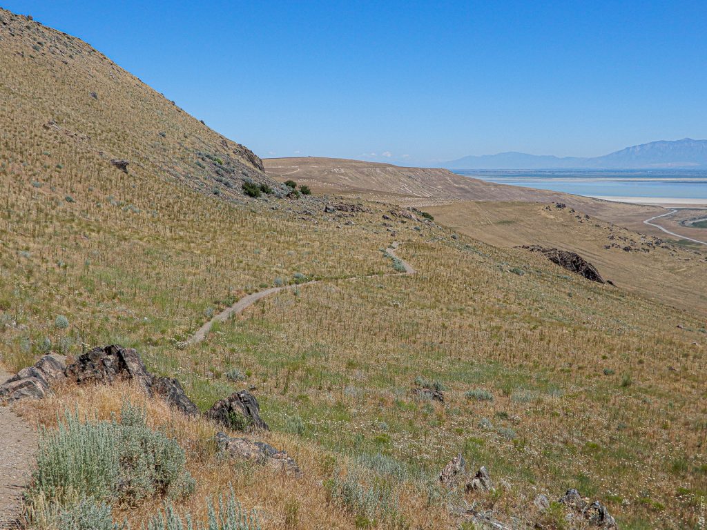
Dooly Knob Trail – Second Switchback (#2)
This is at 5057 ft/1541 m ASL along this prominent Provo bench.
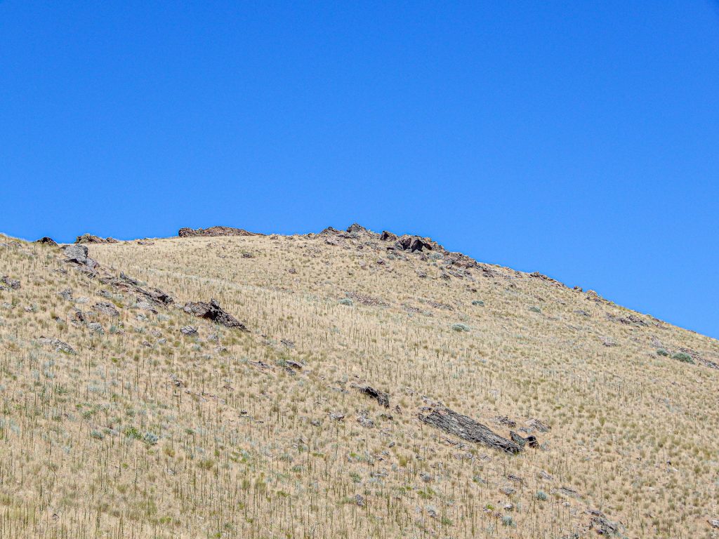
Dooly Knob (#3)
Here I am looking up at Dooly Knob at 5278 ft/1609 m ASL. (For what it is worth, that is one mile ASL.) Notice the desert sky! Wave action from about 16k years ago created those boulders up there on Dooly Knob.
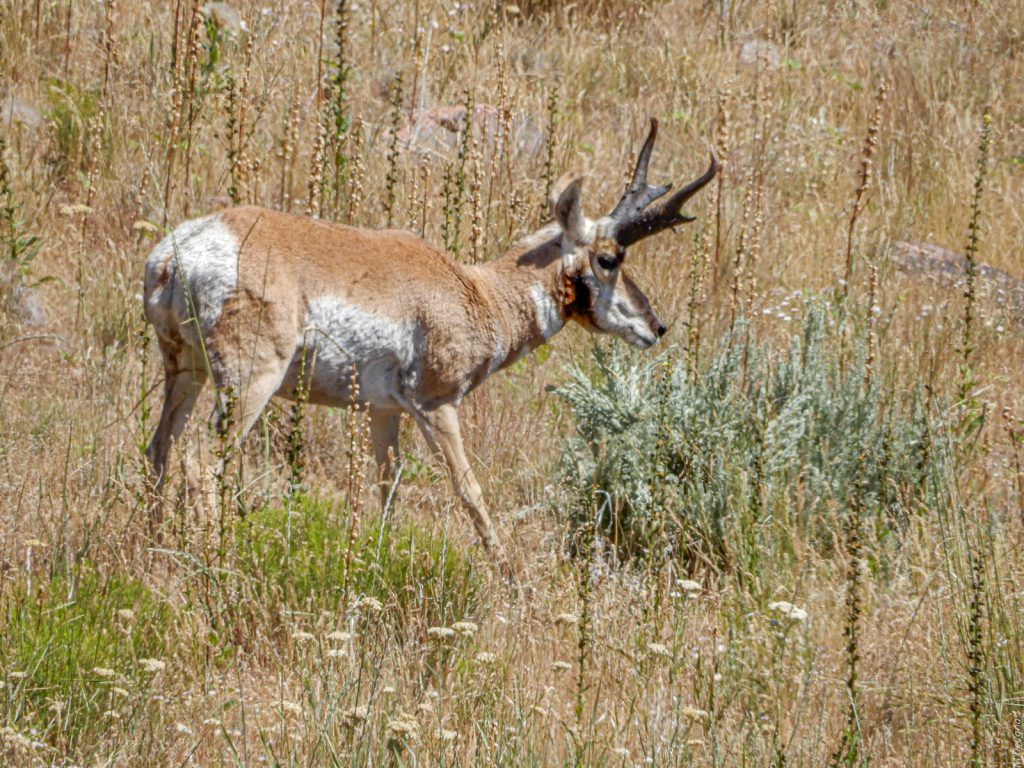
Pronghorn Buck (#4)
As I was enjoying the view on the Provo terraces, this pronghorn leisurely wandered by a few hundred meters away. The black on his nose identifies him as a buck. He was fascinated by this desert shrub which he shook around with his mouth a few times before moving on. The obvious and fairly fresh wound on his throat did not seem to faze him. He may have had an encounter with a coyote.
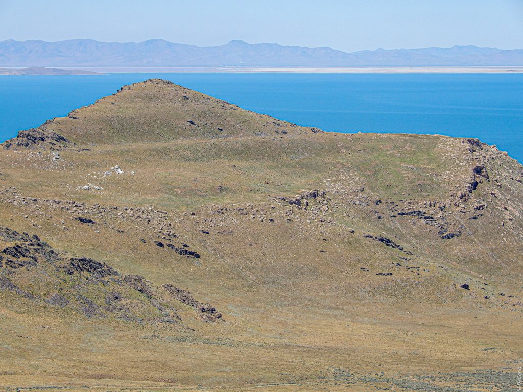
Elephant Head from Dooly Knob (#5)
In this photo I am standing on Dooly Knob and looking west. Elephant Head stands 5126 ft/1562 m ASL. You can see remnants of all three Lake Bonneville shorelines: First is the very prominent Provo bench with other Provo era benches just below it. Second, above the Provo terrace and just under the peak is the more subtle but still noticeable Bonneville bench. And, third, some Stansbury benches are about a quarter way up from the bottom of the photo.
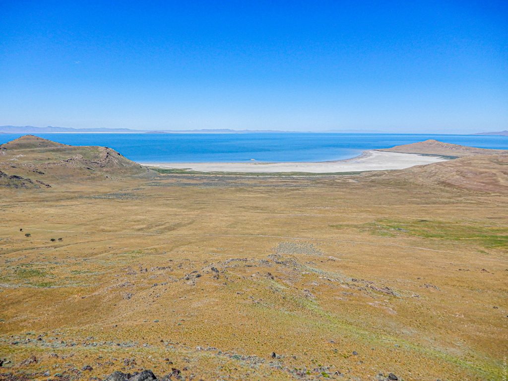
White Rock Bay from Dooly Knob (#6)
Looking WNW with Elephant Head on the left and Buffalo Point on the right.
Whenever I see White Rock, I always remember Memorial Day weekend of 1980. I was the navigator on a sailboat during an overnight 80-mile race. The first turnaround was at White Rock. I will never forget the beautiful evening just before sunset as the boat was between that rock and the shore. There was more water that year. I was frantically triangulating our position with a handheld compass and an unwieldy paper chart while competing boats surrounded us. Only the meter or two of water under the keel us kept us from going aground. The skipper, actually a very good friend, was justifiably screaming at me all the while! We made it out more due to his skills than to my navigating. For younger readers, GPS was still far in the future.

Promontory Mountains from Dooly Knob (#7)
Looking north. In the left foreground is Buffalo Point which anchors the north shore of Antelope Island. In the hazy distance lie the Promontory Mountains which separate the Spring Bay arm of the GSL on the west (left side) and the Bear River arm on the east (right side). The low lying Fremont Island hides Promontory Point. Note that on 10 May 1869, the Central Pacific and Union Pacific Railroads met, not at that point, but at Promontory Summit, 30 mi/48 km farther north.
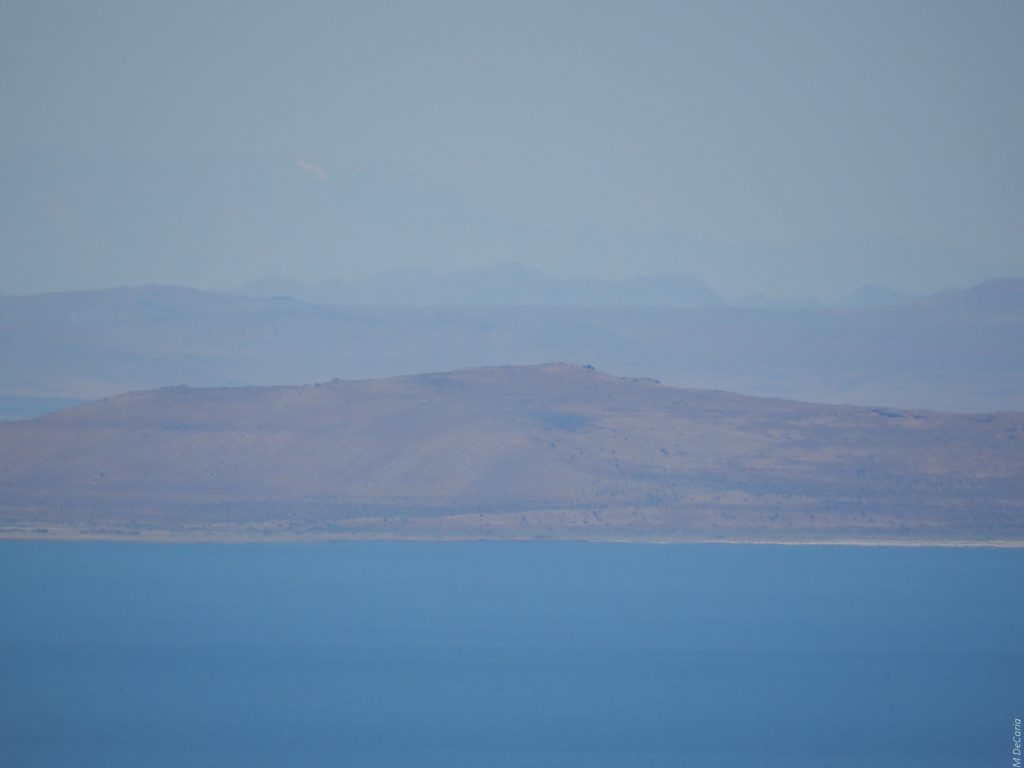
Basin and Range in the Haze from Dooly Knob (#8)
I include this photo for explanatory purposes because it obviously is not art. My goal in the photo is to show that Pilot Peak in Nevada is visible from the Wasatch Front. (The Wasatch Front is the heavily populated narrow urban corridor hemmed in by the Wasatch Mountains on the east and the GSL, Oquirrh Mountains, and Utah Lake on west. Antelope Island is wildland but nonetheless an integral part of the Front.)
The four “ranges” in this photo from closest to farthest are Carrington Island, Lakeside Mountains, Newfoundland Mountains, and the Pilot Range.
You may be wondering where to spot the Pilot Range in the image. If you look halfway above the Newfoundland Mountains and the left top of the photo, you will see a small patch of white, which could be a cirrus cloud. Actually, that is a snow field on Pilot Peak. If you use your imagination, you may be able to make out the ridge line of the Pilot Range. It is admittedly difficult.
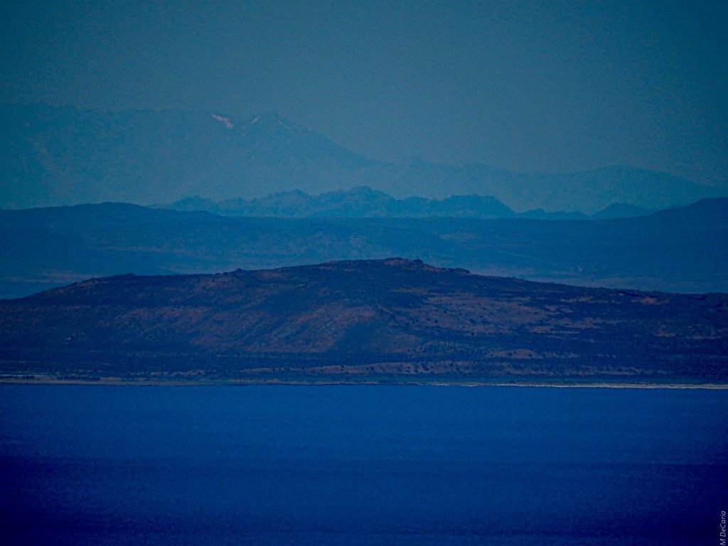
Basin and Range in the Haze from Dooly Knob-False Color (#9)
This is photo #8 rendered in false color to make Pilot Peak stand out.. Pilot Peak’s majesty at 10,719 ft/3267 km ASL still delivers a punch in spite of the fact that it is 97 mi/156 km distant as the crow flies. You can see Pilot Peak close up in photos #15 and #19 in the previous post on the Silver Island Mountains.
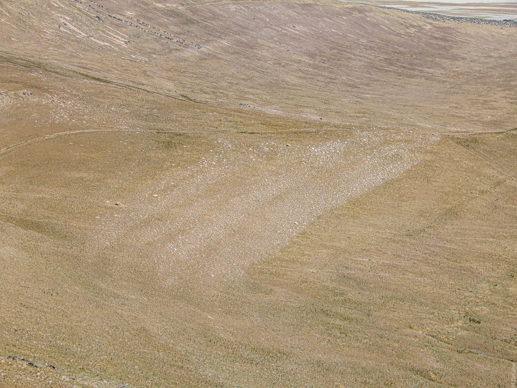
Upper White Rock from Dooly Knob (#10)
Still atop Dooly Knob I am looking north. Looking down from the Bonneville Terrace to the Provo Terrace. Notice how the white rocks are arranged in four tiers apparently caused by wave action on varying beaches of old Lake Bonneville.
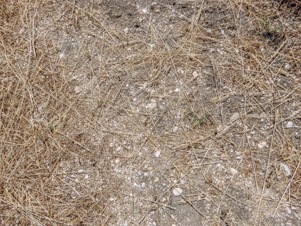
Close-up of Upper White Rock from Dooly Knob (#11)
The white rocks here survive to today because they are on high ground. Perhaps originally, the rocks extended south (bottom of photo) but erosion has since carried them away.

Buffalo Bay (#12)
I have now returned to the present day beach level on the northeast corner of the island. In addition to the Stansbury, Bonneville, and Provo Terraces, there is a less commonly seen Gilbert shoreline on which I am standing. It is nominally 4250 ft/1295 m ASL. Just above it on the ridge, you can see a remnant of the Stansbury shoreline.

On the Buffalo Bay Beach (#13)
The Gilbert terrace is the lower and the Stansbury the higher. Recent research by Dr. Charles G. “Jack” Oviatt has thrown considerable doubt into whether the 1.5k-year Gilbert phase of lake history actually produced any shoreline remnants. The Gilbert episode ended about 11.6k years ago. I have never met Professor Oviatt, but a day on Antelope Island with him would be incredibly special!
Close-up of Buffalo Bay Beach (#14)
Notice the beach gravel, although no lake water may have washed this land for roughly 10k years.

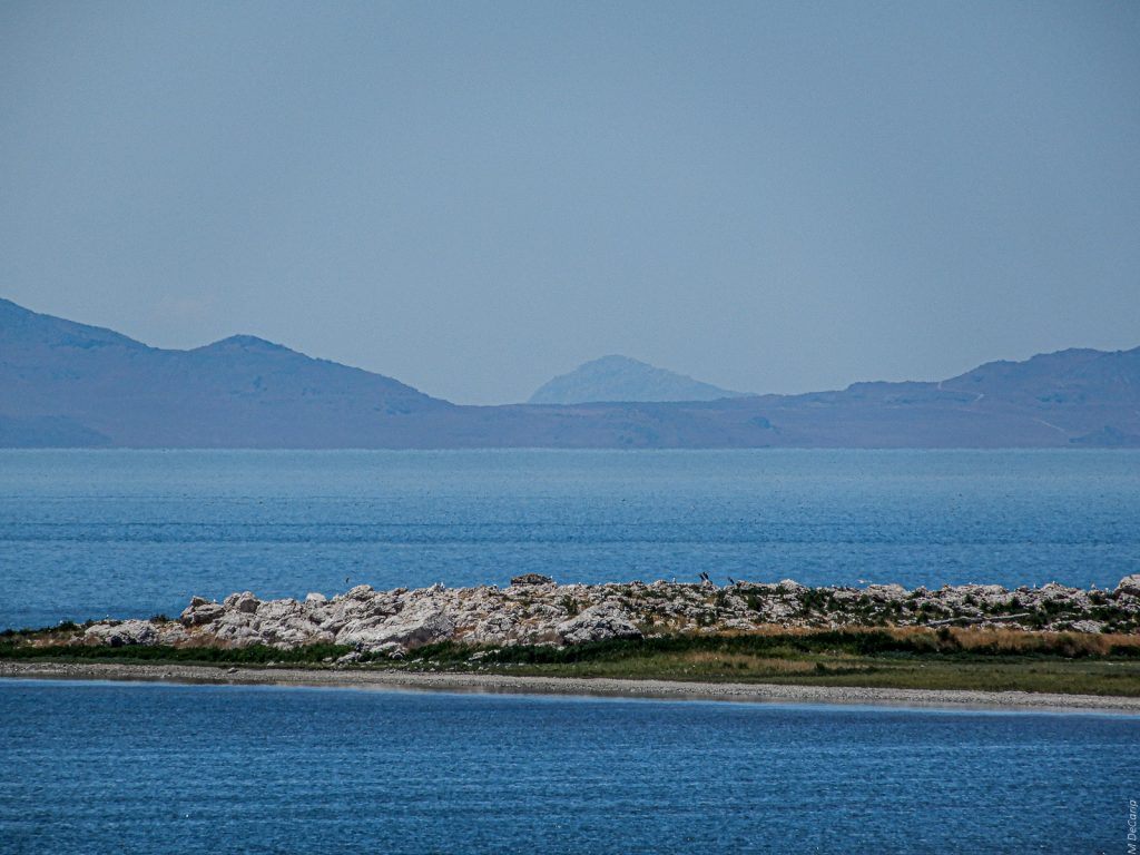
From Ladyfinger Ridge (#15)
Looking WNW. Egg Island lies roughly 0.75 mile/1.2 km offshore. For most of the late 20th century, Egg Island appeared as small pile of white rocks completely surrounded by water. One of my sisters waded out to the island in the early 1970’s, not long after Antelope Island was opened to the public. If you look straight past Egg Island to the Lakeside Mountains, you will see a saddle. In that saddle is a distant peak: Desert Peak in the Newfoundland Mountains. Please take my word for it, it is there.
Desert Peak Behind the Lakeside Mountains (#16)
Desert Peak is 7005 ft/2135 m ASL and is the high point of the Newfoundland Mountains. It sure looks dramatic and mysterious with this telephoto treatment but not to the naked eye as witnessed in the previous photo (#15). It is 58 mi/93 km distant. For a closer view of Desert Peak as seen from the west, please see #18 in the previous post on the Silver Island Mountains.
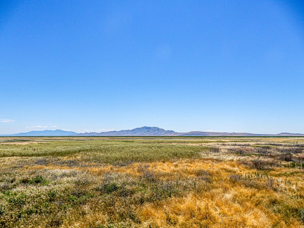
Goodbye to Antelope Island
Looking west from what is sometimes the eastern shore of the GSL, although obviously it is not this year. The entire north to south length of the island is fits into the wide angle frame. The light blue range to the left is the Oquirrh Mountains which form the western boundary of Salt Lake County. I took this photo as the final shot of the day before I undertook the 50-minute drive on urban highways back home.
Another enchanting post! Of course I am a huge fan of yellow and blue (colors of my first wedding). The blue skies and the yellows and gold of the grass are so beautiful. I thought the enhanced versions of the images with Pilot’s Peak looked like paintings.
Once again – it was history that I didn’t not know… The final image happens to be my favorite! Clear and beautiful. Nicely done, Michael!
Thank you for your truly educational comments! Your ability to make exciting that which I fear is dry is amazing. I am delighted that the final image is your favorite. I am somewhat embarrassed to admit that I was tired from the long day and had to force myself to park and take that last shot.
Beautiful and informative. Nothing not to like !!!
I am honored that a desert rat such as yourself would comment on and follow this blog! You are the one who schooled me in looking for Desert Peak and Pilot Peak from the Wasatch Front – and that was a long time ago!