Introduction
On 4 September 2020 Carol and I drove the 65 miles (105 kilometers) around the Silver Island Mountains, a remote range in the Great Salt Lake Desert of Utah. We did not see another person during the loop. ICYMI please see “Questing for Wonder around the Silver Island Mountains-2019.” Here are photos and commentary about this 2020 visit:

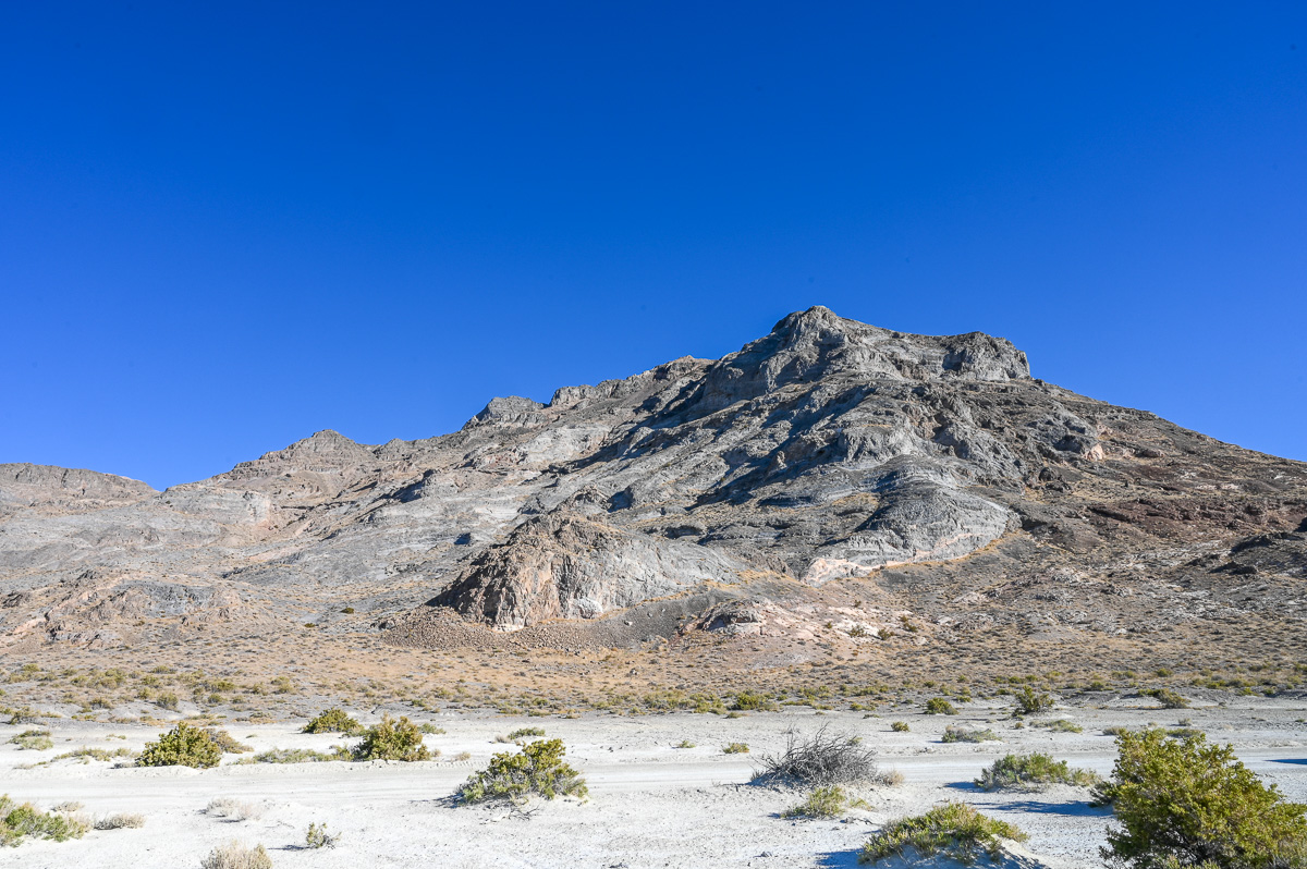
Tetzlaff Peak
Let’s play geological detectives: Do you see the landslide scar left of center about one-third from the bottom? When did it happen? The clue is that the slide slashes through the prominent bench left by Lake Bonneville. That bench marks the Provo level of the ancient lake whose waves formed a beach from 14,500 to 13,500 years ago. Therefore, we know the slide is younger than 13,500 years, recent in geological time. For extra fun, do you notice that the slide stops at a lower lying terrace, also a relic of Lake Bonneville? That is the Stansbury Terrace, which waves formed from 23,000 to 20,000 years ago. Just a few millennia ago, I would have been standing under water here among exotic fish while giant land mammals searched for food and mates.
Outcrop
Being in the presence of this rock stirs wonder in me. I savor the four components of wonder: Joy, surprise, curiosity, and confusion.

Carol and Toyota 4Runner
I asked Carol to drive for much of this outing. As much as I love to drive “The Runner” both on and off pavement, today I preferred to limit myself to photography. Carol is a most skilled driver because she feels the vehicle as an extension of herself. Thank you, Toyota, and thank you, Carol!

White Dome
The time spent in this dome’s presence was my favorite part of the day, but I captured just some of this scene’s beauty. With the camera at my eye, the dome’s massiveness shrunk noticeably. I varied the composition but found only partial success in conveying my emotion. This particular photo snags enough of the wonder, but it is no substitute for inhabiting the dome’s neighborhood. After I realized the lack between reality and photography, I let the camera hang from my neck and just experienced.
Flat Earth? #1
This is the desert floor just off the most eastern point of the Silver Island Mountains. Floating Island stands at the far right. Although the flatness of the desert floor impressed me, the curvature of the Earth is evident because the bottoms of Floating Island and of the distant mountains lie below the horizon. During earlier explorations of this area, I saw relics of the 1846 Donner Party’s wagon wheels here, but not today. For more about the wagon tracks and Floating Island, please see last year’s post, “Questing for Wonder Around the Silver Island Mountains-2019.”

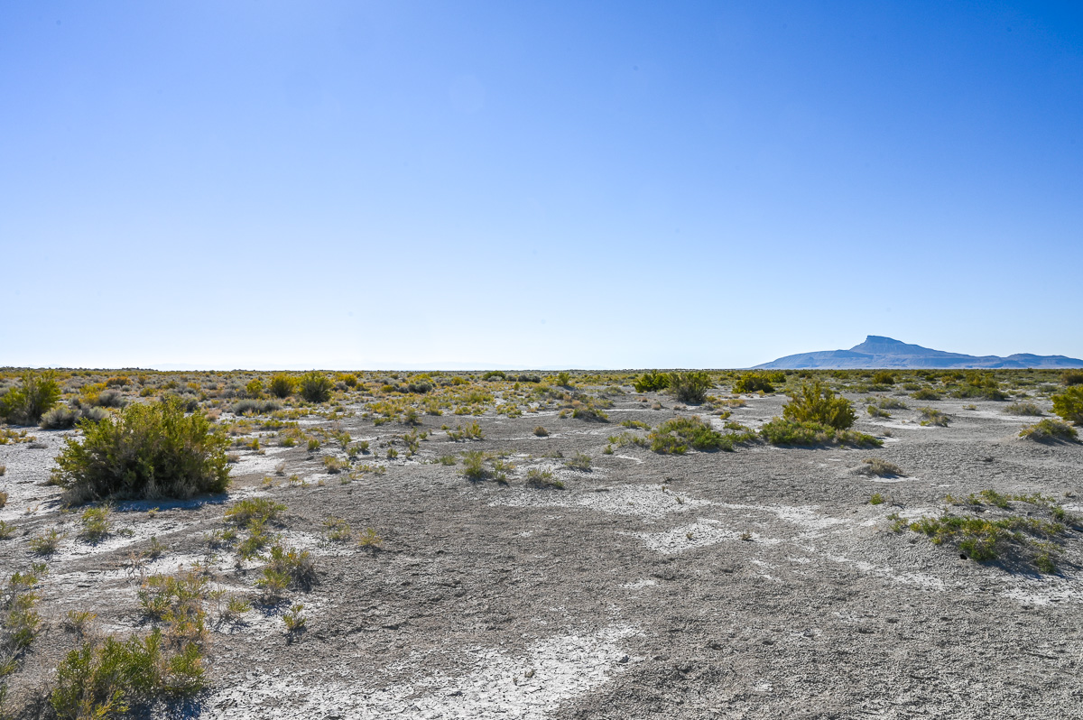
Flat Earth? #2
Taken from the same location as the previous photo but looking east. The Newfoundland Mountains with their high point, Desert Peak, lie on the horizon. We will see Desert Peak again later. The haze along the horizon is from the California, Oregon, and Washington wildfires hundreds of miles behind my back to the west.
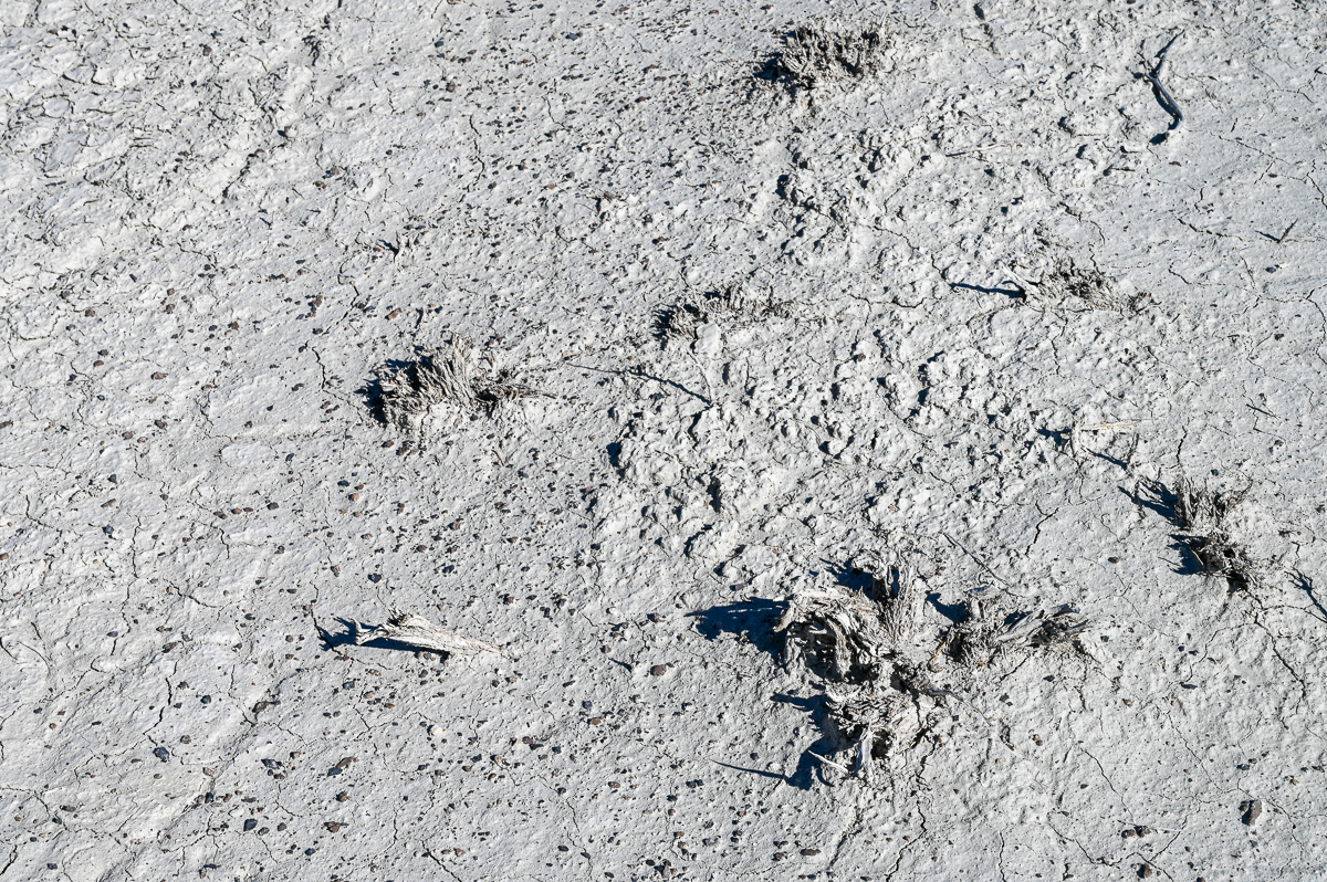
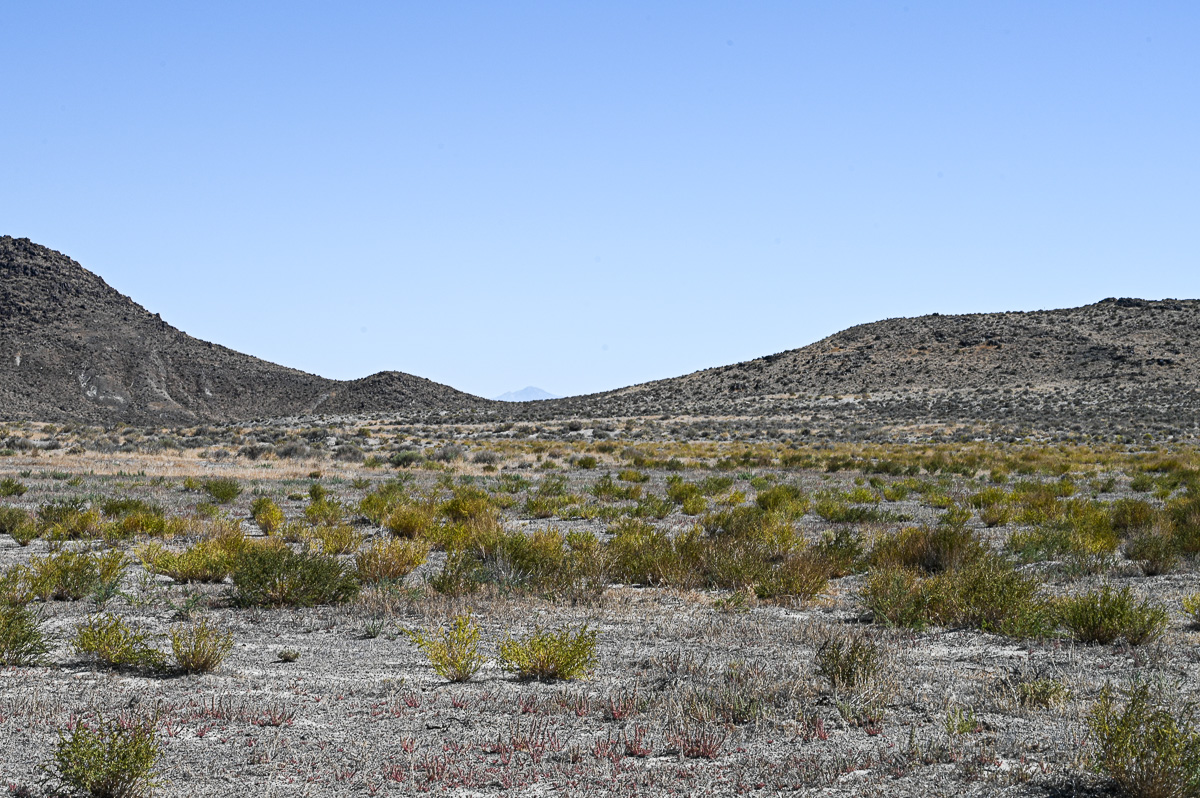
Salt Flat
Such beauty. If you think about it, this tableau represents 4.6 billion years of Sun and Earth history.
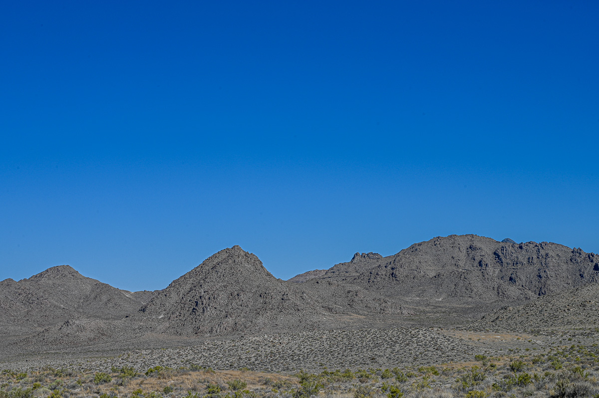
Crater Island Ridgeline
Crater Island makes up the northern section of the Silver Island Mountains. Carol and I left the 4Runner behind at the Donner-Reed Pass, a saddle between the main Silver Island Mountains and the Crater Island extension. We hiked 4 miles (6.4 kilometers) roundtrip along the side of this ridge. The only evidence of humans was the dirt road under our feet, left over from 20th-century mining exploration.

Gilbert Beach on Crater Island
I include this photo for the dark line just below the ridgetop. That line marks another terrace similar to the Provo and Stansbury terraces seen in the earlier photo, Tetzlaff Peak. The parent Lake Bonneville created those terraces, but the child Great Salt Lake made this one 10,500 years ago. A glance at the altimeter on my wrist clued me in on the identity of this terrace, which is at a much lower elevation than the better known terraces. One rarely sees Gilbert benches except on Antelope Island or scattered about the Great Salt Lake Desert, like here.
Desert Peak
Desert Peak in the Newfoundland mountains to the east plays peek-a-boo across Crater Island. When we were children, one of my brothers (now CDR Don DeCaria, USN, retired) and I would strain to see Desert Peak way to west from the crowded urban corridor of Davis County. On clear days we could see the tip of the peak behind the Lakeside Mountains on the west side of the Great Salt Lake. Then, we did not have the means to come here to the West Desert, but we would look at maps and dream about it. (Also, please see From Ladyfinger Ridge (#15) in a previous post, “Questing for Wonder on Antelope Island.”)

Bureau of Land Management Benchmark
Near the end our outing, we stopped for lunch on the western flank of the mountains. The next two photos after this one show the landscape around this 1961 benchmark. (Note: By using the coordinates: Township 2 North, Range 18 W, Section 31 S 1/4, I was able to locate the spot on the Bonneville Salt Flats Utah 30 x 60 minute topographic map which the U. S. Geological Survey issued in 1979.)

Pilot Peak and the Pilot Range
Standing at the benchmark in the previous photo, I am looking northwest. The Pilot Mountains run south to north as they straddle the Utah-Nevada border. Pilot Peak itself lies 2.1 miles (3.4 kilometers) west of border in Nevada, but the remainder of the range to the right of the peak coupled with the rest of the real estate in this photo is in Utah. Pilot Peak rises to an elevation of 10,719 feet (3,267 meters) above sea level with a prominence above the salt flat of 5,725 feet (1,745 meters). (Note: These photos in this post represent a small fraction of the Great Basin desert and range province. Geographically, Utah is divided into three parts: One-third Great Basin, one-third alpine mountains, and one-third Colorado Plateau.)
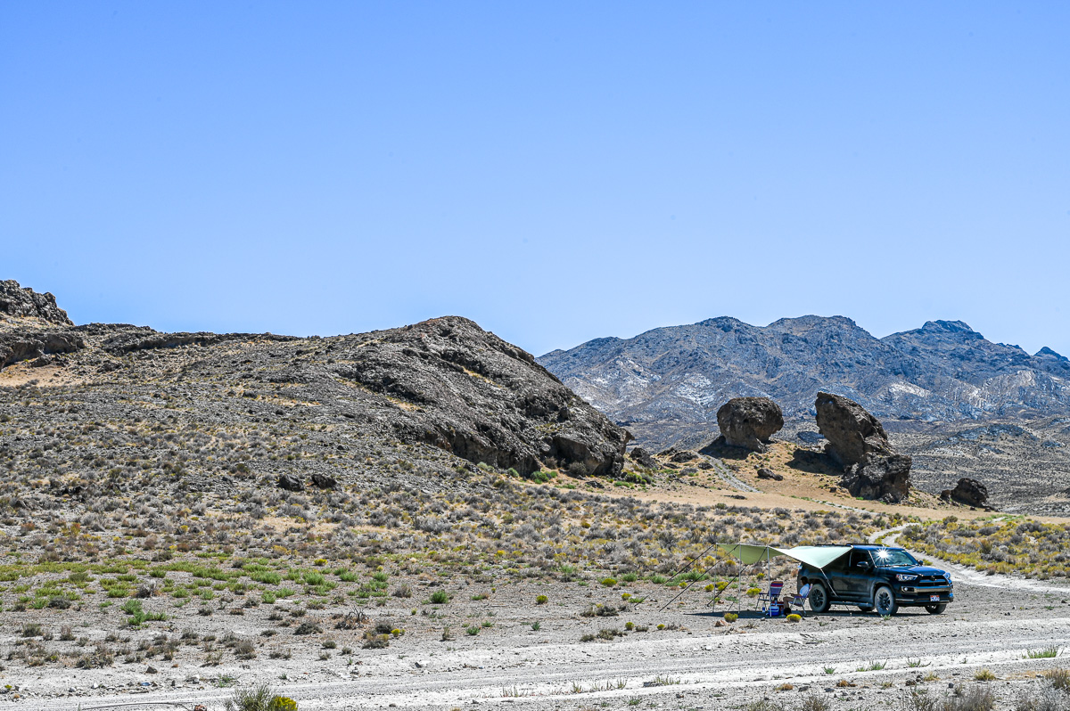
Lunch Stop
From the same benchmark I am now looking east, right at the southern part of the Silver Island Mountains. We have about an hour to go to finish the loop.

4Runner Back at Wendover Best Western
The next morning just before the drive home. The fine desert dust is a badge of honor, at least for a few days.
Endnote
I mentioned Utah’s three geographical areas above. For a look at alpine scenery please see the recent post, “Questing for Wonder while Hiking to Dog Lake.” I do not yet have a post on Utah’s Colorado Plateau. I have visited there many times, but not since starting this blog. I feel some outings coming on in 2021 and starting with Capitol Reef, one of my top ten favorite places on this planet. I first visited Capitol Reef in 1973 when it was unknown, and have returned a score of times. I can hardly wait to get there again.
Best regards,
Dr. Michael
The very first image caused me to gasp. The blue sky was almost shocking. Always fun to read about your adventures!
That blue sky was amazing! I felt lucky to capture it because the smoke from the west coast wildfires was all around that day. The beautiful sky rivaled the one we saw on the Arctic coast of Iceland two years ago.
I love the deserts of Utah and Northern Nevada. When I was a preteen I used to fantasize about being the sheriff of Elko County or White Pine County Nevada, and just driving around all day through the desert. I don’t see any desert here in Pennsylvania, so its nice to get my fix through your photos.
As always I love your comments! Your fantasy is very fun, and I am glad that I could contribute to it in a small way. Thank you!