Introduction
In 1969 Davis County constructed a causeway from Syracuse, Utah to the north end of Antelope Island, the largest island in the Great Salt Lake. Since then I have visited the island more times than I can count and have accumulated a couple thousand photographs of the place. I acknowledge my inner psychologist who insists that Antelope Island is a preoccupational interest for me. With embarrassment I admit to the accusation. Nevertheless, here is another post.
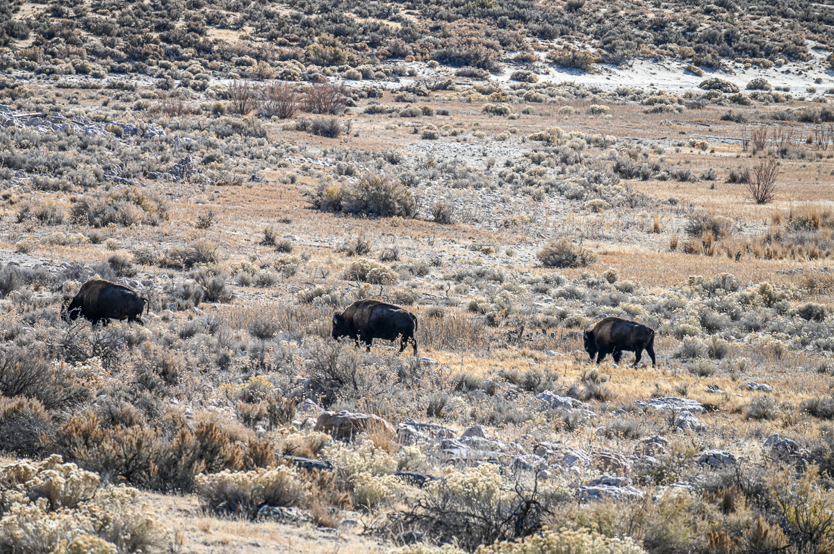
Three Bison at Lunch
A display at the island visitor center says that a bison consumes 40 pounds (18 kilograms) of grass a day.

Bison on the Edge of Bridger Bay
For the record bison are not creatures to be toyed with. They can run at 40 miles per hour (64 kilometers per hour) for several minutes. How can you tell if you are too close to a bison? They look at you. On 2 June 2014 Carol and I had just started an 8-mile circular hike on the island when we encountered a bull on one side of the trail and his cow on the other side. She was grazing and he was protecting her. He stared at us with unmistakable menace. We turned around and hiked the opposite direction. Later on we came across another bull and cow similar to the first pair, but that bull was not as threatening as the first. We stopped to keep our distance, and after about ten minutes the pair moved on. BTW I remember the exact date because it was Carol’s first day of retirement, and we celebrated with the hike.

More Bison
I was able to get these photos safely because I was near my vehicle and was using a telephoto lens. I spent about 60 minutes taking photos of these bison. Although they did not look at me, they of course were aware of me. It was an honor to be in their company, and I am glad to have photos to remind me of that hour.

Antelope Island Looking South
This is the first of four photos looking in the cardinal directions. Notice my bison companions in the foreground.
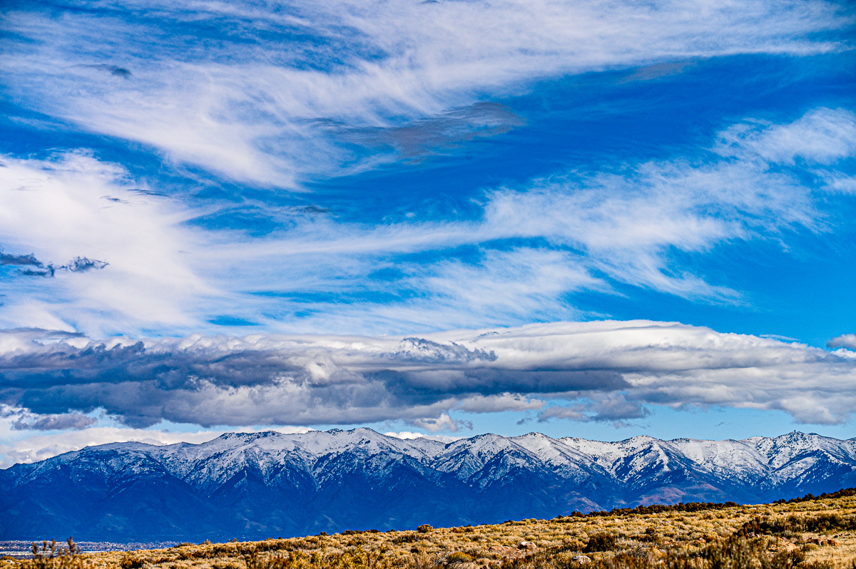
From Antelope Island Looking East
It had snowed in the mountains and rained hard in the valley during the night before. The rain had cleaned the air and the storm system left enough moisture to produce these mountain-caused (orogenic) clouds. The Wasatch Mountains here have a ridgeline of 9,000+ feet (2,750 meters) above sea level and a prominence of nearly 5,000 feet (1,525 meters) above the valley floor.
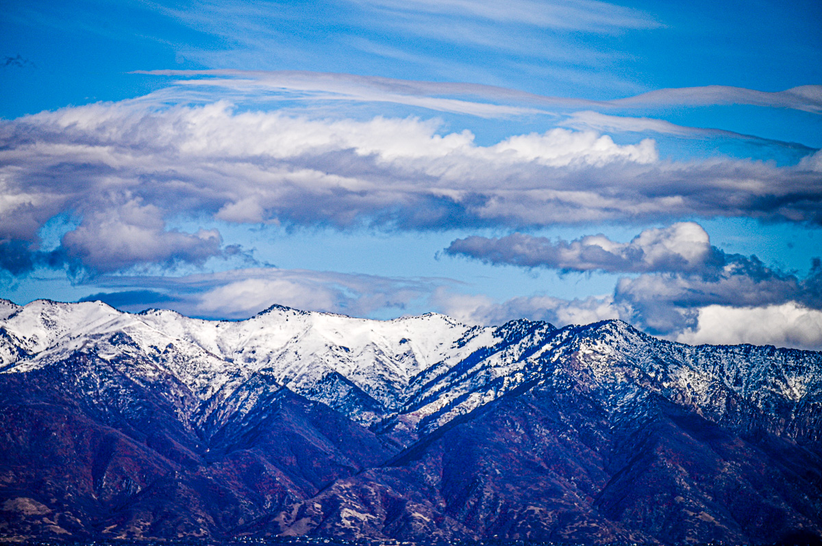
Close-up from Antelope Island Facing East
Notice the red of the scrub mahogany on the lower flanks of the mountain. Also, notice the indigo in the left-facing ravines. The clear air allowed the camera sensor to perceive the indigo. As a child growing up next to these mountains, I easily understood the words, “Purple mountain’s majesty,” from the song, America the Beautiful.
From Antelope Island Facing North
The trailing edge of the weather system as it moves from northwest to the southeast. The upper atmosphere jet makes cotton candy of the cirrus clouds.
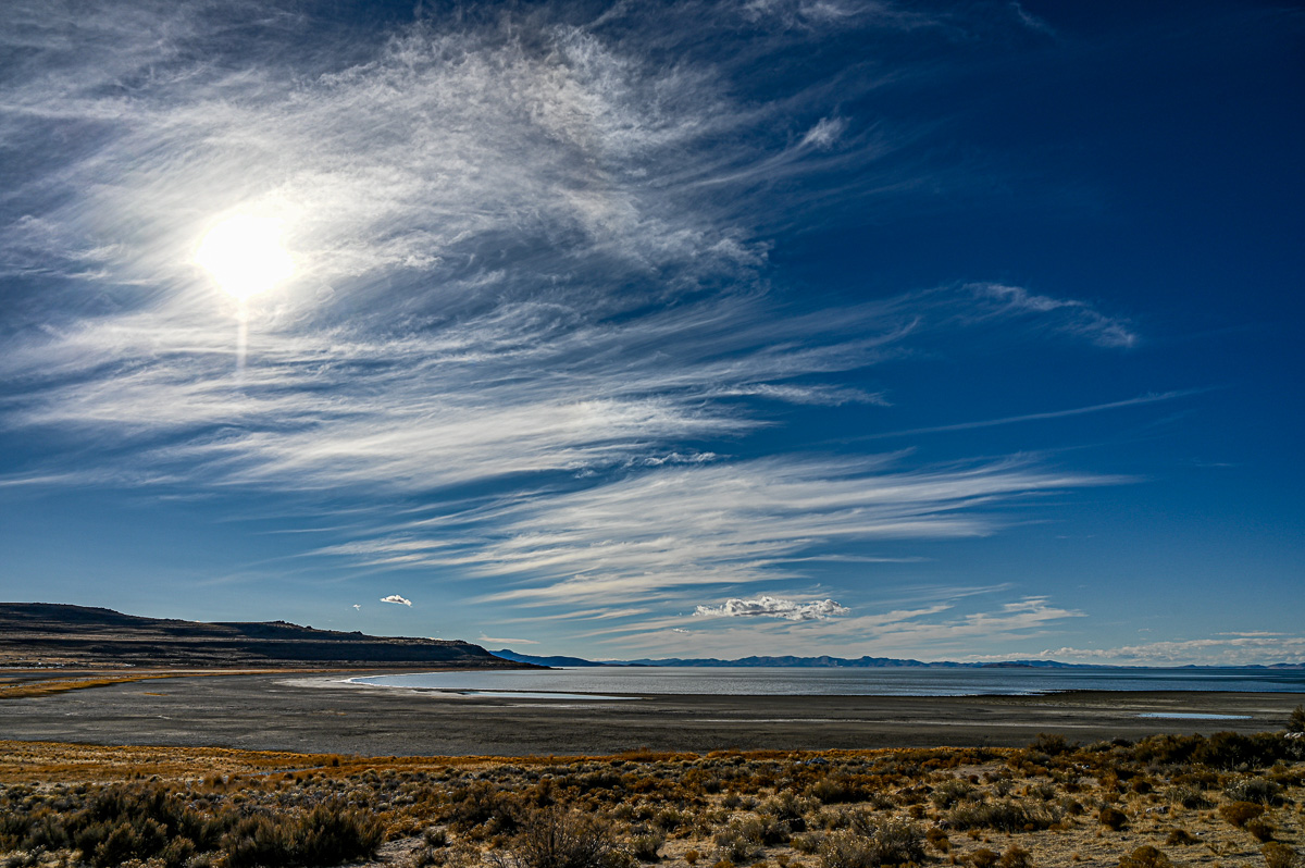
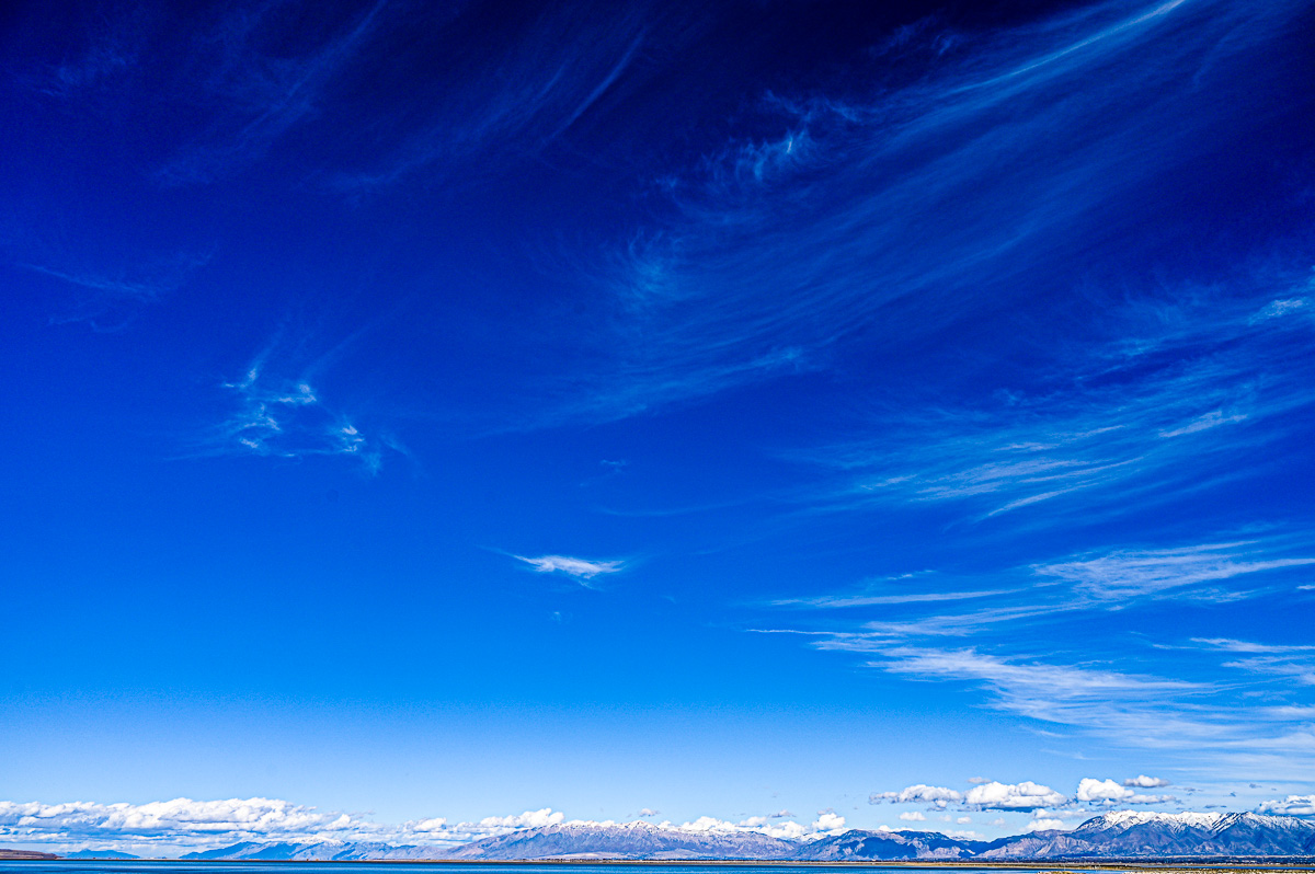
From Antelope Island Looking West
The Great Salt Lake stretches to its western edge and the Lakeside Mountains.
Endnote
All these photos were taken from within an area of few hundred square meters in 90 minutes.
As always I am grateful for your kind attention,
Dr. Mike
I have many fond memories of going to Antelope Island with you and our siblings. Thanks for sparking these memories again!
You are welcome! We were lucky to have a desert wildland right next to our town. Our good fortune has continued with the state of Utah buying the island and preserving it as a park. Thank you for your comment!
As usual I enjoyed your images of our local landscape. Antelope island is extraordinary and you have captured its distinct beauty in your photos. I especially like the care you took to honor the bison and give them their space. I wish more people had the same amount of respect that you demonstrate for these giant mammals. A nice read, Michael!
It has been a lesson for me to respect bison for who they are without having them “see” me. I love how you have crafted your words. Thank you!